


A melting glacier in Nepal was a time bomb. There are more to come.

By JASON GULLEY
Like much of the world, I’ve watched and rewatched videos of the catastrophic flood that have filtered out of Nepal with horror and sadness.
But unlike many, I have an intimate knowledge of this part of the world, where I first traveled as an undergraduate geology student in 2005 to study how glaciers in the Khumbu region disintegrate into hazardous lakes. I’ve made six expeditions there over the past two decades.
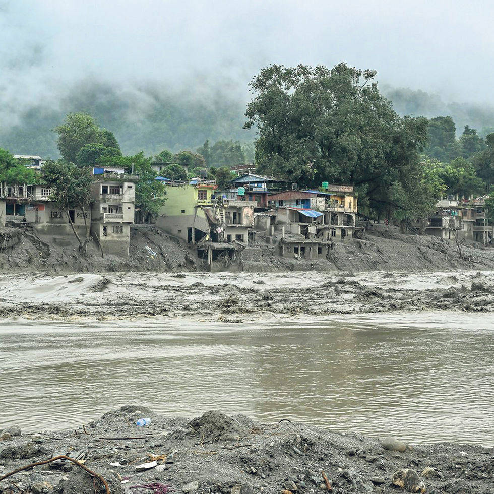
Because of the remote location, scientists don’t know what precisely triggered the recent disaster — yet. What’s clear at this point is that a giant hunk of glacier peeled off the side of the mountain, tumbled down 4,000 vertical feet and slammed into a tributary of the Bhotekoshi River in China.
Moments later, a wall of rocks and water blasted through the Gyirong Port building as the flood barreled down the valley. The source of the water remains a mystery.
In many catastrophic floods in the Himalayas, glacier lakes are to blame. When Nepal’s glaciers were healthy, they bulldozed down mountains and pushed up piles of rocky debris hundreds of feet high to form features glaciologists call moraines.
As temperatures across the Himalayas have soared, glaciers have shriveled, and those moraines have trapped meltwater. That has created lakes that can grow until they replace the glacier feeding them — or until a disturbance causes them to drain catastrophically.
As I reported last year with New York Times climate science reporter Raymond Zhong, a landslide smacked into a glacier in the Khumbu region in 2024, launching a flood wave over the moraine dam that sent 100 million gallons of water through the heart of Thame, a Sherpa village nearby. Luckily, no one died. But the flood destroyed the village’s school, medical clinic, several lodges and homes.
Data shows that glacial failures — a scientific term that includes glacier detachments and rock-ice avalanches — have happened dozens of times since 1900 in the China-Nepal border region.
While last week’s flood had a massive landslide, there didn’t appear to be any glacier lakes below it, making it a bit of an anomaly. Some scientists have speculated that the impact of a piece of glacier falling 4,000 feet could have pulverized the ice into water.
But we know that there will be more floods — and some may be far worse.
Unless carbon dioxide emissions are curbed, scientists project that warming across High Mountain Asia will erase as much as 75% of the remaining glaciers by 2100. Meltwater pooling behind moraines and in depressions exposed by the ice will transform thousands of glaciers into large lakes, each one a potential ticking time bomb for vulnerable communities downstream.
Over the past 20 years, I’ve watched this process in action. On my earliest trips to the region, I would scamper up the Ngozumpa, Nepal’s longest glacier, to my research sites, where I would step across a long, ribbon-shaped puddle, near the Sherpa village of Gokyo. In 2025, when I returned to report on glacier flooding hazards for the Times, it had become a lake, nearly 750 feet wide and 850 long.
The flood in Thame a few years ago showed that smaller lakes can be dangerous on their own, but they also play a critical role in creating larger lakes — and potentially larger flood hazards. The Ngozumpa, like many of Nepal’s glaciers, is blanketed by thick, rocky debris shed by adjacent mountains. Glaciologists once thought this debris would insulate ice from melting, but now we know that lakes can supercharge melt. Silt and mud trapped by meltwater turn lake water a dark gray color. And just as wearing a black T-shirt on a sunny day makes you warmer, that dark color heats up the water in the lakes to melt the surrounding ice.
Warm water can create caves that turn glaciers into Swiss cheese, rotting them from the inside out. When these tunnels collapse, they create new depressions that become lakes. And rapid lake growth can quickly consume a glacier.
The Imja glacier is a dramatic example. Aerial images from the 1950s show that it had but a handful of small lakes on the surface. By 1978, a single lake consumed nearly the entire glacier tongue. By 2021, the lower Imja glacier had been converted into a lake that was 1.7 miles long, 0.4 miles wide and more than 400 feet deep. The only thing holding it back is an unstable dam of ice, sand and rock.
Imja’s lake is one of the largest, and once one of the most dangerous, glacier lakes in Nepal. In 2016, the Nepali army excavated an 11-foot-deep trench to lower the level of the water — and the magnitude of the flood that would be unleashed if it were to burst. An outburst in 1985 that flooded Thame had prompted the move. Thirty-eight years later, I was there to document the effects of a second burst.
As a geologist, I don’t know what can be done to address floods like these. But one thing I do know is that they are coming.


Comments