


Aguas Buenas gets updated territorial plan aimed at safer growth and stronger economic development

By THE STAR STAFF
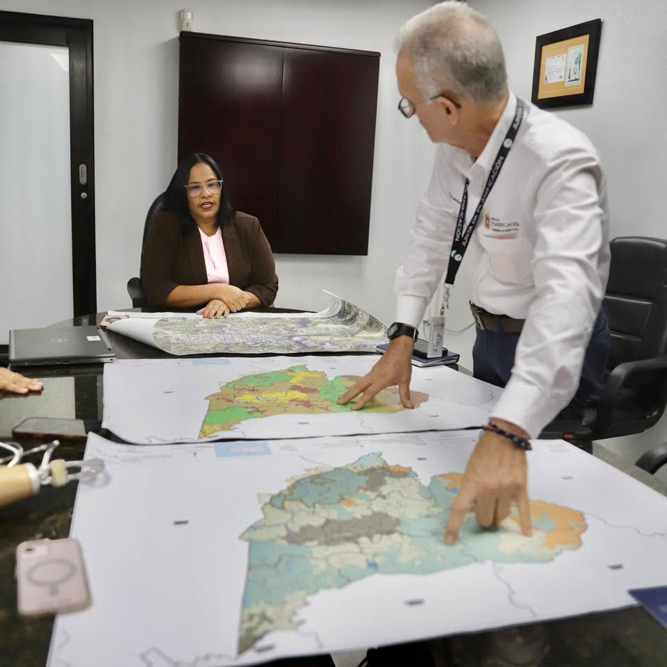
The Puerto Rico Planning Board has delivered a newly updated territorial map to the Municipality of Aguas Buenas, marking the first comprehensive revision of the town’s Master Zoning Plan (Plan de Ordenación Territorial) in more than 15 years.
Planning Board Chairman Héctor Morales Martínez met with Mayor Karina Nieves Serrano on Tuesday to present the updated instrument, which officials say will guide safer, more organized and more sustainable development for the mountain municipality.
The revised plan formally expands and redefines the boundaries of Aguas Buenas’ Urban Center, incorporating key public facilities such as the Municipal Government Center, nearby residential areas and recreational spaces. According to the Planning Board, the changes are designed to strengthen urban development, improve public services and establish a clearer long‑term vision for growth.
“This is the result of a joint effort between the municipality, the Community Boards and the administration of Governor Jenniffer González Colón, represented by the Planning Board,” Morales Martínez said. “Aguas Buenas now has an updated instrument to guide development decisions, promote new economic opportunities and protect the resources that define its identity.”
A major component of the revision is the integration of updated natural‑risk data, including lessons learned from the 2017 hurricanes and the municipality’s mitigation plans. Officials said this information will help steer development toward safer zones, reinforce infrastructure and improve the town’s ability to withstand future natural events.
The plan also expands protections for natural and agricultural lands, including the Aguas Buenas Cave and Cavern System Natural Reserve. It outlines a Program of Action with strategic projects aimed at boosting economic development, improving infrastructure and enhancing quality of life for local communities.
“This new plan is an essential tool to build the Aguas Buenas we want for future generations,” Mayor Nieves Serrano said. “It gives us a clear path to promote economic development, address infrastructure needs and protect our natural resources while keeping the safety and well‑being of our communities at the forefront.”
The revision process included broad public participation through Community Board meetings and public hearings held across its three phases. Residents, government agencies and other stakeholders contributed recommendations that were incorporated into the final document.
Morales Martínez emphasized that the updated plan complies with the Puerto Rico Municipal Code, the Regulation for Municipal Territorial Planning and all applicable environmental laws.
“When government, municipalities and communities work from a shared vision, planning becomes a concrete tool for development and well‑being,” he said. “This map captures that collective vision and turns it into a guide for action.”


Comments